
Reproject data
Transform all registered geometry columns after you know the source CRS and need coordinates in another CRS.
Create a projected copy
reproject returns a new DataFrame. The input table retains its coordinates and CRS.
using GeoDataFrames
using GeoDataFrames: reproject!
using CairoMakie
using NaturalEarth

countries = select(
    DataFrame(naturalearth("admin_0_countries", 50)),
    :NAME,
    :CONTINENT,
    :geometry,
)

netherlands = subset(countries, :NAME => ByRow(==("Netherlands")))
web_mercator = reproject(netherlands, EPSG(3857))

(original = GeoInterface.crs(netherlands), projected = GeoInterface.crs(web_mercator))
(original = EPSG{1}((4326,)), projected = EPSG{1}((3857,)))The result reports EPSG:4326 for netherlands and EPSG:3857 for web_mercator.
Compare CRS side by side
Plot the same world geometries in geographic and projected CRS to show both the coordinate scale and the shape change:
world = subset(countries, :CONTINENT => ByRow(!=("Antarctica")))
world_3857 = reproject(world, EPSG(3857))

fig = Figure(size = (780, 360))
ax1 = Axis(fig[1, 1], title = "EPSG:4326 (lon/lat)")
plot!(
    ax1,
    world.geometry;
    color = :lightgray,
    strokecolor = :gray,
)

ax2 = Axis(fig[1, 2], title = "EPSG:3857 (meters)")
plot!(
    ax2,
    world_3857.geometry;
    color = :lightgray,
    strokecolor = :gray,
)
fig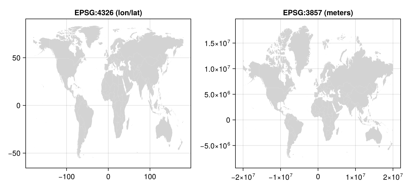
Transform in place
Use reproject! when replacing the table's coordinates is intentional:
reproject!(netherlands, EPSG(3857))
GeoInterface.crs(netherlands)EPSG:3857The result is EPSG:3857, and netherlands.geometry now contains projected coordinates.
Keep GIS coordinate ordering
always_xy = true is the default. It interprets geographic coordinates in traditional GIS order: x, y, or longitude, latitude. Set always_xy = false only when the CRS's authority-compliant axis order is required:
authority_order_places = DataFrame(
    geometry = GeoInterface.Point.([(52.3702, 4.8952)]),
)
authority_order = reproject(
    authority_order_places,
    EPSG(4326),
    EPSG(28992);
    always_xy = false,
)
Confirm the source CRS before transforming; assigning a CRS label is not a transformation. See setcrs!, manage geometry metadata, the metadata reference, and the metadata and CRS background.